Staying grounded in data: How geotechnical instrumentation keeps public projects on track
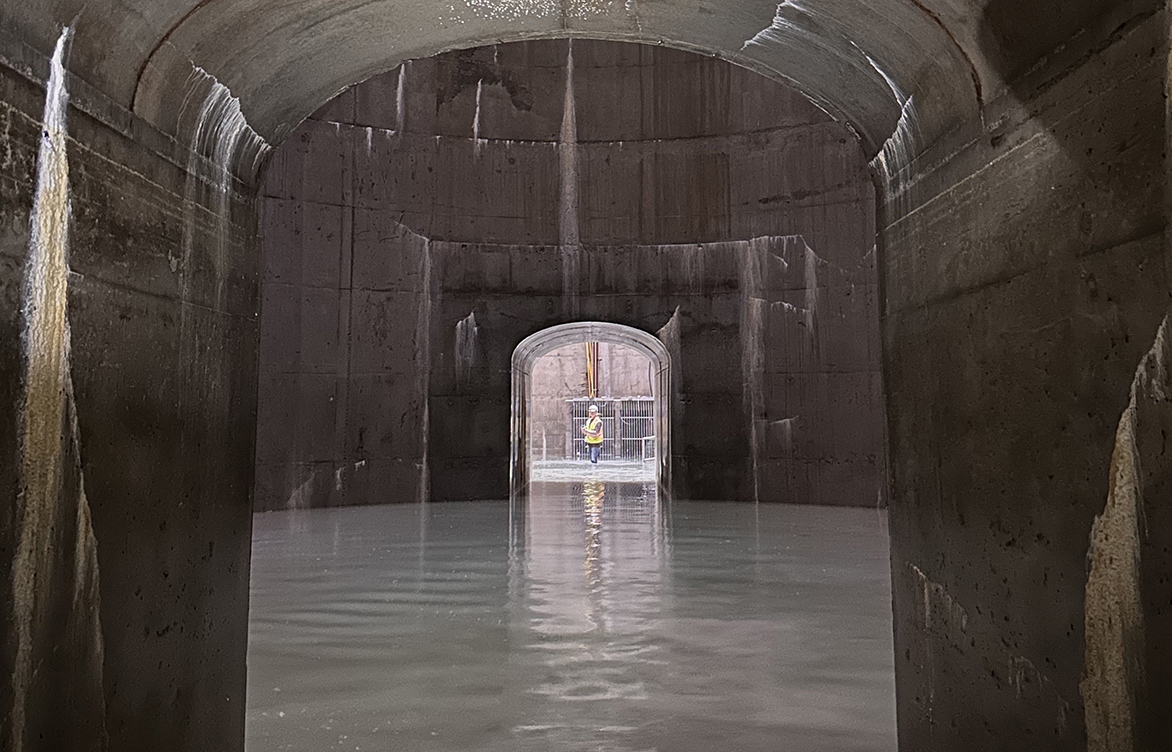 What happens below ground can determine a project’s success above it. On Minnesota’s I-35W stormwater storage facility project, near real-time geotechnical instrumentation gave Barr critical visibility below ground, helping the team manage risk, validate design assumptions, and support safe construction in challenging high-groundwater conditions.
Article summary: Unexpected ground conditions can derail public infrastructure and construction projects. In this article, we explore how geotechnical instrumentation and real‑time monitoring provide critical visibility below ground to support risk management, protect public investments, and keep projects on track.
When a public infrastructure project encounters unexpected ground conditions, the risks ripple far beyond the jobsite. Delays affect commuters. Unexpected costs affect taxpayers. And safety risks affect entire communities. That’s why understanding what’s happening below the ground’s surface isn’t just a technical exercise. It’s a critical part of keeping public projects on track.
Geotechnical instrumentation isn’t just about collecting data; it’s about giving project teams the confidence to make more informed decisions sooner, when the risks are greatest.
A successful instrumentation and monitoring program doesn’t just happen by accident. It requires early planning, alignment with technical and managerial teams, experienced installation, and, just as importantly, ongoing care and interpretation. When those pieces come together, instrumentation becomes a trusted part of the construction process rather than an afterthought and sets the stage for monitoring how soil and groundwater behave as work progresses.
See what’s happening underground
“One accurate measurement is worth a thousand expert opinions.” —U.S. Navy Rear Admiral Grace Hopper
At Barr, we recognize that an effective instrumentation program is more complex than just purchasing sensors. It’s about gaining reliable insight into how the ground is actually behaving. In high-risk construction environments, making decisions without that visibility can quickly become costly.
Precise geotechnical instrumentation allows engineers to monitor how soil and groundwater respond to construction activities in real time. In urban environments, where infrastructure is tightly packed and the margin for error is slim, this level of visibility is essential.
As U.S. Navy Rear Admiral Grace Hopper famously said, “One accurate measurement is worth a thousand expert opinions.” When conditions are complex and consequences are real, accurate data provides the clarity teams need to act with confidence.
Put monitoring to work
Our teams have seen firsthand through our work on public sector projects how geotechnical monitoring can transform complex projects. From deep stormwater storage facilities to highway expansions to landslide stabilization, instrumentation provides the data needed to make informed decisions, manage risk, and keep projects moving.
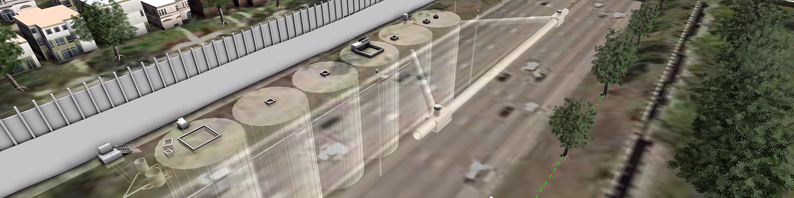
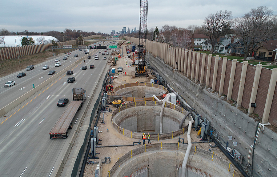
That approach was put to the test on a stormwater storage facility project adjacent to a major interstate in Minneapolis, Minnesota, where groundwater sat just feet below the pavement and excavation depths reached nearly 90 feet.
Barr implemented a comprehensive monitoring system that combined vibrating-wire piezometers, strain gauges, ShapeArrays, and automated total stations to provide the project team with near real-time insight into soil movement, groundwater pressure, and potential subsidence. That visibility allowed the team to respond quickly and confidently as conditions changed, without slowing down the project or compromising safety.
Connect design to long-term performance
Across multiple public infrastructure projects in Minnesota and North Dakota, we’ve seen how strong documentation, paired with instrumentation, helps connect early design assumptions to long-term performance while reducing uncertainty at every stage along the way.
On projects involving embankment stabilization, landslide stabilization, and column-supported embankment (CSE) systems, detailed subsurface characterization and site mapping established reliable design parameters. Field and laboratory testing, combined with numerical modeling, then informed stabilization strategies.
During construction, comprehensive instrumentation programs (including inclinometers, piezometers, and large‑scale sensor networks) provided real‑time data on groundwater pressures, ground movement, settlement, and load transfer. That information verified installation quality and validated design assumptions. Over time, ongoing monitoring reduced uncertainty, informed decision-making, managed risk, and protected both new and existing infrastructure.
Reduce risk while protecting public dollars
For public sector clients, risk mitigation is both a technical goal and a fiduciary responsibility. Geotechnical instrumentation helps agencies like the state department of transportation, city utilities, and transit authorities:
- Spot problems early, before they become delays or change orders
- Protect existing infrastructure, from roads and utilities to nearby buildings
- Create accountability, using data to verify contractor performance
- Reduce public safety risks, including ground failure and flooding
In our stormwater storage facility project, instrumentation data validated design assumptions, guided excavation sequencing, and confirmed that dewatering systems were working as intended. When unexpected conditions arose, such as boulder encounters or pump outages, the team had the data needed to adapt without compromising safety or schedule. That same value carried into a highway embankment stabilization project, where Barr used instrumentation to quantify subsurface conditions, define the full extent of the landslide, improve model accuracy, and support a targeted stabilization design.
Keep projects moving
Instrumentation doesn’t just prevent problems, it enables progress. By providing continuous feedback, monitoring systems help teams make decisions faster and with greater confidence. This is especially valuable in alternative delivery models like CMGC (construction manager/general contractor), where collaboration and trust are essential. When everyone, from owner to contractor, can review the same data, conversations shift from opinions to solutions, and decisions happen faster.
In the case of the stormwater facility, instrumentation enabled the contractor to optimize dewatering rates, adjust excavation and sheet piling methods, and verify that subsidence risks were being managed. The result? A complex, high-risk project was delivered on schedule with minimal disruption to the public.
When developing geotechnical instrumentation plans for public infrastructure, consider the following:
- Tailor instrumentation to project risks: Focus on areas like groundwater, soil movement, and adjacent structures.
- Design with redundancy for verification: Multiple sensors and methods help with reliability and robustness.
- Integrate with construction sequencing: Monitoring should align with key milestones.
- Use data to inform decisions: Don’t just collect data; analyze, alert, and act on it.
- Communicate clearly: Instrumentation data should be accessible to all stakeholders, from engineers to agency leaders, and easily understood.
Build confidence with accurate data
Public sector projects demand transparency, accountability, and resilience. Geotechnical instrumentation can help deliver all three. By providing ground truth, literally, instrumentation helps public agencies manage risk, protect communities, and deliver infrastructure people can rely on.
Planning to incorporate geotechnical instrumentation or monitoring on your next public infrastructure project? Contact us to learn how we can help.
About the author
Joel Swenson, senior geotechnical engineer, has two decades of geotechnical experience that includes managing geotechnical field investigations, analysis, design, reporting, and instrumentation monitoring for public and private clients. He conducts near real-time monitoring using both contact and remote sensors and mesh communication networks, employing a variety of online methods and programs to provide reports, view data, and set alarm thresholds. Joel also monitors assets (buildings, storm and sanitary sewers, bridges, mine highwalls, piling, tunnels, highways, retaining walls, and railways) for construction-related impacts and performance issues and provides near real-time online reporting for project teams and owners.
Related projects
I-35W stormwater storage facility
Barr supported design and construction of the I‑35W stormwater storage facility by implementing a geotechnical monitoring program that established baseline conditions and tracked subsurface performance throughout construction in a constrained, high‑groundwater urban environment. This instrumentation-driven approach provided critical data on ground behavior, helping manage construction risk, validate design assumptions, and support safe installation of the deep underground storage system.
Twin Ports Interchange ground improvement design
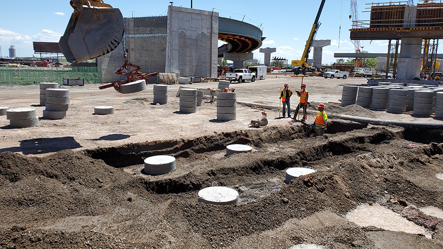
Barr implemented an extensive geotechnical monitoring program for the Twin Ports Interchange project, using instrumentation to evaluate settlement, structural response, groundwater pressures, and load transfer within the column-supported embankment system. The resulting data helped the Minnesota Department of Transportation and the project team confirm system performance, reduce uncertainty, and support safe construction in challenging subsurface conditions.
Embankment stabilization for Highway 73
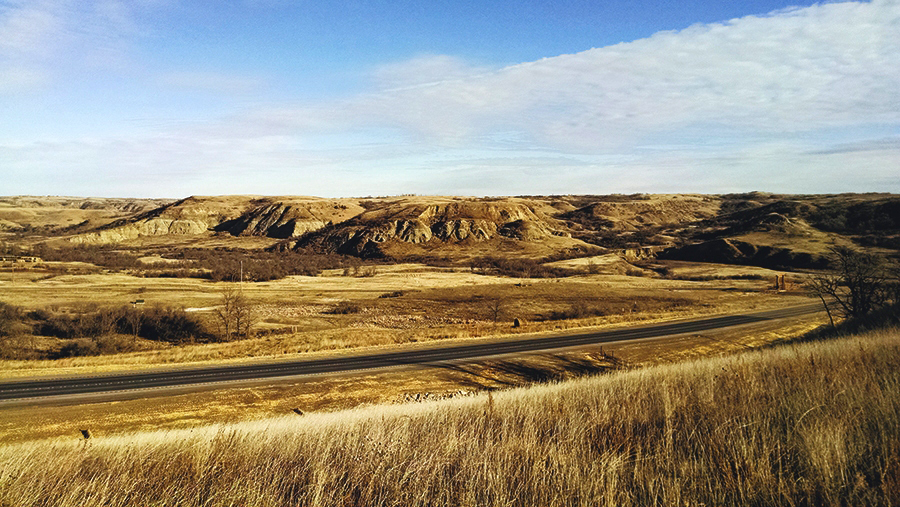
Barr used geotechnical instrumentation on the Highway 73 project to monitor groundwater pressures and slope movement in near real time, providing critical data that revealed the true extent of the landslide and informed accurate modeling, risk assessment, and development of a targeted stabilization design.
Landslide stabilization and corridor repair for state highway
To support stabilization of landslide-damaged segments along Minnesota Highway 210, Barr implemented a comprehensive geotechnical instrumentation program. Our team installed inclinometers and piezometers during the investigation to monitor ground movement and groundwater pressures, and later deployed more than 2,700 sensors to verify slope stability and highway performance during and after construction. The resulting data informed design decisions, validated stabilization measures, and helped manage ongoing risk across the corridor.