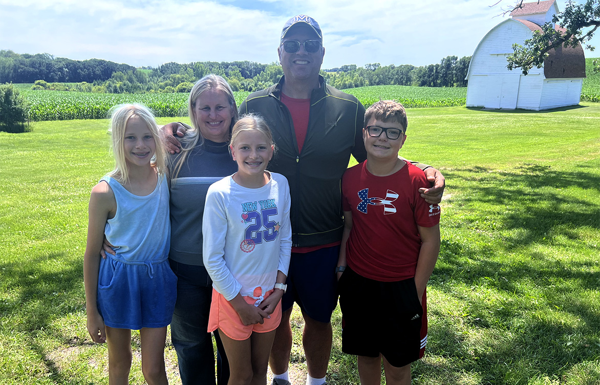
 When he’s not working on flood protection projects, Jason—shown here with his family—enjoys spending time outdoors, maintaining the land, and supporting his kids in their many activities.
Expert Q&A: Helping cities navigate flood risk
As cities confront aging infrastructure and increasing climate pressures, flood risk reduction has become a critical—and complex—challenge that demands thoughtful planning and collaboration.
Levees are critical infrastructure for communities built along our nation’s waterways. What might appear to be a simple mound of dirt or stone structure is actually a highly engineered system that protects homes, businesses, and emergency services from the risks of flooding. As cities confront aging infrastructure and increasing climate pressures, flood risk reduction has become a critical—and complex—challenge that demands thoughtful planning and collaboration.
Barr’s Jason Westbrock, a vice president, senior water resources engineer, and member of Barr’s board of directors, has spent more than two decades helping communities navigate these challenges. Based in Bismarck, North Dakota, he has led projects across the U.S. and Canada, but one of his most notable efforts was close to home—the Mouse River Enhanced Flood Protection Project in the Mouse River Valley, a region in north-central North Dakota that includes Minot and surrounding communities near the Canadian border. Jason brings deep technical expertise and a strong commitment to the people behind the projects. His work highlights the importance of careful assessment by qualified engineers and the value of resilient infrastructure tailored to each community’s unique needs. Here, Jason shares his journey, insights, and what keeps him coming back to the work.
How did you get involved in the Mouse River Project?
Through partnerships, networking, persistence, and a little bit of “right-time, right-place” good luck, our team was selected to develop a preliminary engineering report—which served as a long-range plan for flood protection in the Mouse River Valley.
What made the 2011 flood so devastating?
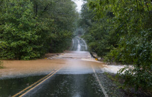
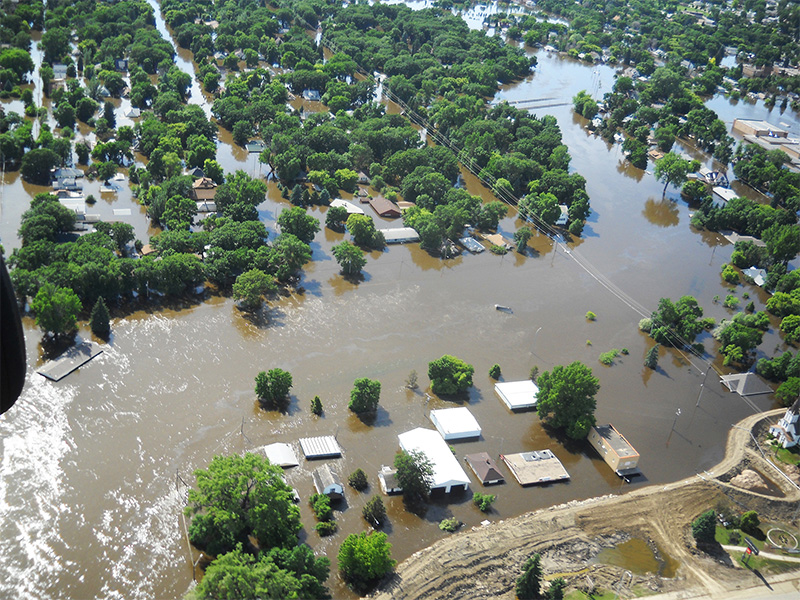
The Mouse River has a long history of flooding, even going back to the 1800s. The federal government embarked on a project in the 1980s and ‘90s that was designed to protect against snowmelt events. But in 2011, we had heavy snow followed by intense rain, which overwhelmed the system. The river accessed its floodplain, and the residents of the valley incurred damages in excess of $1 billion.
The housing inventory was already at record lows due to the emergence of the nearby Bakken Formation as a viable source of crude oil. The flood displaced about a third of the city from their homes. Families moved in with other families while they rebuilt their homes. In reality, 100% of the community was impacted—either directly or by hosting those who were. The urgency was real. The community needed answers, and the state stepped in to fund a study.
How did Barr help guide the project through its phases?
We started with a two-phase study—first focusing on urbanized areas, then expanding to rural reaches to assess impacts on farmland and agricultural infrastructure. Once the plan was in place, the state asked the local sponsor, the Souris River Joint Board, to take the lead on implementation.
Because federally funded systems were already in place, certain federal guidelines had to be followed, and Barr was one of the few firms with experience obtaining federal permission under Section 408 of the Rivers and Harbors Act, which governs alterations to civil works projects managed by the U.S. Army Corps of Engineers.
What sets Barr’s levee upgrade services apart?
The design standard for flood risk reduction has typically been the 100-year event—the 1% chance flood. But that’s not flood-proofing; it’s an insurance standard. Climate cycles are changing, and we’re seeing more extreme precipitation events and longer wet cycles. The Souris River Joint Board and the City of Minot chose to design for the flood of record—the event that actually happened. It’s a bigger investment, but it builds a more resilient community.
Barr brings world-class geotechnical engineering, structural design, and hydraulic modeling together in a cohesive team. We also excel at navigating regulatory complexity and bringing stakeholders together to find holistic solutions. And we’ve been successful in identifying federal grant opportunities to help offset local costs.
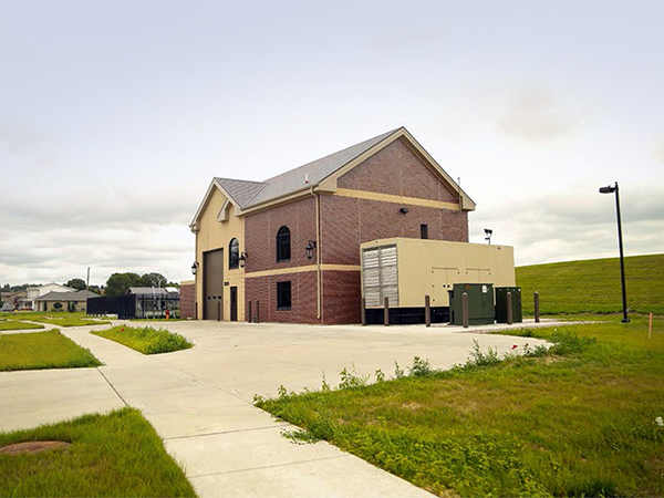
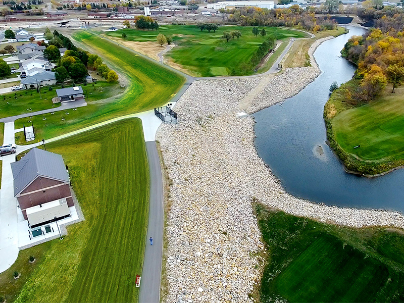
We also prioritize sustainability—minimizing soil import/export, using locally sourced materials, and designing infrastructure that blends into the community. We’ve built trails, improved neighborhood connectivity, and designed ADA-accessible features. One pump station was even designed to look like a house in the middle of a neighborhood.
What drew you to levee work—and what keeps you going?
I’ve always been fascinated by water—watching it move and understanding its power. What drew me to levee work was seeing the devastation flooding can cause and knowing we can help reduce that risk. Flood-risk reduction projects create tangible community benefits. You only have to live through one flood to see the value of the investment.
What keeps me going is working with smart people, solving big challenges one step at a time, and being part of a team that’s appreciated by both our clients and the community. At the end of the day, it’s about knowing that the work we do makes a real difference in people’s lives—and that’s what keeps me coming back.
When you’re not working on flood protection or water projects, how do you like to spend your time?
Outside of work, I like to enjoy North Dakota’s abundant natural resources, work on our family homestead, and shuttle my three middle schoolers to their various activities.
Contact our team to learn more about our flood risk reduction services.
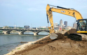
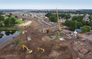
Image gallery (below)
-
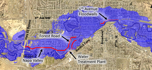
A location map shows phases of the Mouse River Enhanced Flood Protection Project overlaid with the 100-year floodplain, identifying key areas of investment.
-
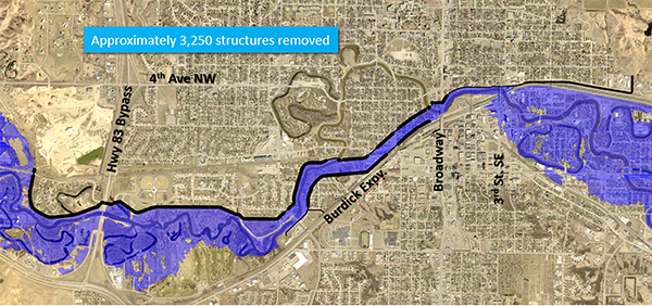
A floodplain map shows projected changes after completion of future phases of the project, including the removal of approximately 3,250 structures from the floodplain.
-
The finished Perkett Ditch Pump Station in Minot, North Dakota, was engineered to resemble a neighborhood home, blending essential flood infrastructure into the community landscape.
Image gallery