How adaptive level control systems are transforming flood management
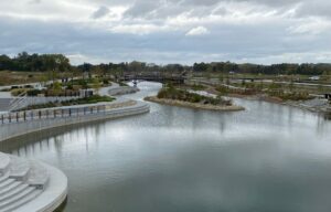
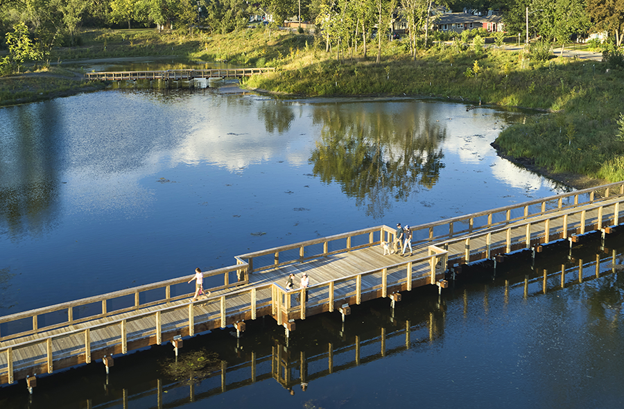
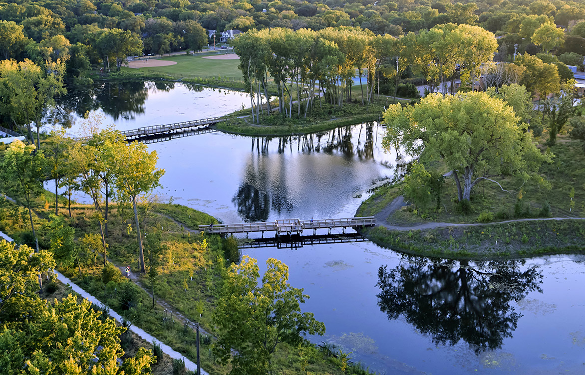 The City of Edina, Minnesota, uses an adaptive level control system that leverages rainfall forecasting to predictively lower water levels in Weber Pond, reducing flood risk in the surrounding neighborhood.
Adaptive level control systems (ALCS) are emerging as a scalable, cost-effective solution for communities facing larger storms and increasing flood-risk pressures. By using real-time monitoring, automated controls, and rainfall forecasting, ALCS help maximize existing stormwater infrastructure to improve flood mitigation and water quality. This article explores real-world ALCS applications and highlights new statewide research that offers practical guidance for water management practitioners.
Communities across the country are feeling the strain of larger, more frequent precipitation events—and with it the challenge of storing enough runoff to prevent flooding. In the upcoming release of the National Oceanic and Atmospheric Administration’s (NOAA) Atlas 15 update, design precipitation depths are expected to increase, meaning many regions will soon face even greater pressure to manage larger volumes of runoff. For fully developed watersheds, that means finding creative, cost-effective solutions.
Instead of building new costly infrastructure, adaptive level control systems can be retrofitted to existing water management infrastructure to help communities make the most of existing storage and conveyance systems.
One promising approach gaining traction nationally is the use of adaptive level control systems. These smart systems combine gates, valves, pumps, and automated controls with real-time monitoring and even precipitation forecasting or artificial intelligence (AI) to improve stormwater management. Instead of building new costly infrastructure, ALCS can be retrofitted to existing water management infrastructure to help communities make the most of existing storage and conveyance systems. In addition to managing stormwater to reduce flood risk, ALCS also has the proven potential to reduce downstream pollutant loading and improve water quality.
At Barr, we’re helping clients implement ALCS on a variety of scales, supporting them in their transition to automated systems that allow adaptive management of their operations. We’ve recently completed a research project to advance understanding of ALCS and develop guidance for water management practitioners statewide. This research was supported by funding from the University of Minnesota through the Water Resources Center, the Minnesota Stormwater Research Council, and the Minnesota Clean Water, Land, and Legacy Amendment. Explore the full research report and supporting materials—including an extensive literature review and compilation—on the University of Minnesota Water Resources Center page. A downloadable PDF of the report is available at the end of this article.
A scalable solution
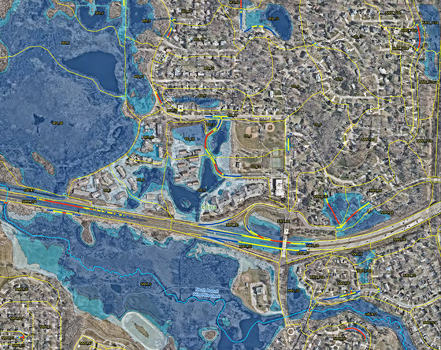
What does the implementation of this look like in action? At a regional level, the Nine Mile Creek Watershed District (NMCWD) in Hennepin County, Minnesota, is using watershed-wide hydrologic and hydraulic modeling to evaluate opportunities to retrofit ALCS control structures throughout a network of lakes, streams, and reservoirs. In this complex urban system with high flood flows during large, intense rainfall events, Barr is exploring use of a system that employs a combination of controls, with some functioning independently and others operating based on response in upstream lakes.
The goal? To determine whether a watershed-wide ALCS approach can lower flood levels, reduce peak flows, and minimize flood risk without negatively impacting infrastructure or the creek. To support real-time decision-making, NMCWD is also exploring Riverware, a software platform that simulates and optimizes water management under pre-defined operational rules and decision logic. Together, these efforts aim to unlock the full potential of ALCS to maximize existing storage for flood mitigation.
On a local scale, the City of Edina, Minnesota, has been using an ALCS since 2023 that leverages rainfall forecasting to predictively lower water levels in Weber Pond, reducing flood risk in the fully developed Morningside neighborhood. What makes this project stand out is its multi-benefit approach: it transformed an existing city park into optimized flood storage while adding new recreational amenities, scenic trails, and native plantings that restore local ecology. Beyond enhancing community spaces and reducing flood risk, the project improves water quality by holding back water after a storm event, allowing sediment particles to settle in the pond. This forward-thinking approach has earned national and state recognition, including a 2025 National Recognition Award from the American Council of Engineering Companies, the Grand Award and First Runner-Up People’s Choice Award in the 2025 Engineering Excellence Awards from the American Council of Engineering Companies of Minnesota, and the 2024 Project of the Year from the American Public Works Association–Minnesota Chapter.
On a smaller scale, Ramsey-Washington Metro Watershed District (RWMWD) in Minnesota is proving that smart technology can deliver big water-quality wins. Since 2023, the district has been using an ALCS as part of its Willow Pond Continuous Monitoring and Adaptive Control (CMAC) project. By collecting real-time water level data, the system can automatically divert flows to a spent-lime filtration system, reducing total and soluble phosphorus. The result? Improved water quality for downstream impaired lakes and proactive long-term watershed health.
Navigating regulatory hurdles
ALCS implementation is experiencing fast-growing interest, but it also poses numerous challenges for regulatory agencies because the systems may not align with current regulatory frameworks. For those managing stormwater systems or lake outlets, securing a permit for ALCS projects is an important factor to consider. Barr has helped our clients successfully navigate the regulatory process for these complex projects, engaging agencies early in the design process. As part of the RWMWD Phalen/Keller Automated Outlet Project, Barr worked with the RWMWD and the Minnesota Department of Natural Resources (DNR) to develop an operations plan that is consistent with local and state requirements and achieves the project’s flood-risk mitigation goals.
For those managing stormwater systems or lake outlets, securing a permit for ALCS projects is an important factor to consider.
Our clients are recognizing the value and opportunities presented by ALCS. The RWMWD is evaluating the feasibility of ALCS implementation to optimize outlet operations on other lakes in the watershed to reduce flood risk, prevent downstream stream bank erosion, and improve water quality. Building on the success of the Weber Pond ALCS in Edina, Barr is partnering with the city to identify additional locations that could benefit from new ALCS outlets, while exploring ways to optimize storage and developing an integrated operations plan on three more lakes.
For both projects in the RWMWD, we’re working side-by-side with clients and regulatory agencies to navigate potential regulatory constraints. At the same time, we’re using results of geomorphological analyses to develop discharge guidelines that will safeguard the ecological health of the receiving streams.
Streamlining ALCS operations
Given the varied physical components of a typical ALCS, more intensive or specialized operations and maintenance may be required compared to the standard passive gravity outlets. As our clients gain experience with ALCS, we continue to develop ways to simplify upkeep and keep systems running smoothly. For example, we are collaborating with the RWMWD to automate the Phalen-Keller outlet system. By integrating the Minnesota DNR-approved operations plan with lake level information, rainfall forecast data, and real-time rain gauge readings, the system can automatically determine the settings for the outlet gate structures.
Across all geographies, we recognize the necessity of creative solutions to improve water management, especially in fully developed areas with limited space and finite resources. There are many different approaches to managing excess water, but ALCS have shown great potential and success in developed communities. Every project requires a tailored solution, considering that each watershed, receiving system, and ultimate project and operation are different. The ability to clearly define project goals, gain a deep understanding of the system, and navigate the regulatory approval process is key for the successful implementation of ALCS projects.
Looking to optimize flood storage in your stormwater management system? Contact our team of experts.
About the authors
Brandon Barnes, vice president and senior water resources engineer, has nearly two decades of experience providing a wide range of water-resource management services. A highly regarded modeler, his project work includes coincidental-frequency analyses, water-balance calculations, digital flood-insurance-rate maps (DFIRMs), letters of map revision (LOMRs), and one- and two-dimensional hydrologic and hydraulic modeling. Brandon also designs stormwater and water-quality BMPs and oversees stormwater permitting. He enjoys evaluating existing systems and identifying strategies to optimize system performance.
Sarah Stratton, vice president and senior water resources scientist, has more than 26 years of stormwater management experience. A certified floodplain manager, she has been involved in flood-control studies; FEMA flood-insurance studies, including countywide map-modernization updates and digital flood-insurance rate mapping (DFIRM); and hydrologic and hydraulic studies (including HEC-RAS and XP-SWMM modeling). Sarah regularly works with cities, watershed districts, counties, and state and federal agencies on stormwater management, stormwater infrastructure assessments, flood-risk reduction options, and surface-water quality analyses and studies.
Cory Anderson, vice president and senior water resources engineer, has 18 years of experience with water resources engineering. He specializes in hydrologic and hydraulic modeling, risk and uncertainty analysis, and probabilistic environmental modeling. His work includes storm sewer modeling, flood control design, and unsteady-state hydraulic analysis of rivers and diversions. Cory’s passion lies in understanding how water and people affect one another—and in developing engineering solutions that benefit both while reducing risk and impact.
Janna Kieffer, vice president and senior water resources engineer, has 25 years of experience in water resources management, serving as a project principal and technical expert for cities and watershed management organizations. She specializes in hydrologic and hydraulic modeling, water quality modeling, flood-risk reduction planning, and infrastructure vulnerability assessment. Janna also completes water management plans, lake management studies, engineering feasibility studies, and water resources permitting.
Download files
- adaptive-level-control-systems-final-report.pdf (.pdf, 5.56 MB)